Cold holds on before midweek warm-up across the Hudson Valley
Cold overnight ahead with freeze alerts in place, then milder air returns by Thursday.
More Stories

There has been a noticeable shift across the Lower Hudson Valley, as much cooler air has settled in since the weekend. After last week’s stretch of 80-degree warmth, temperatures have remained stuck in the 40s and 50s since Sunday, making for a chilly start to the new week.
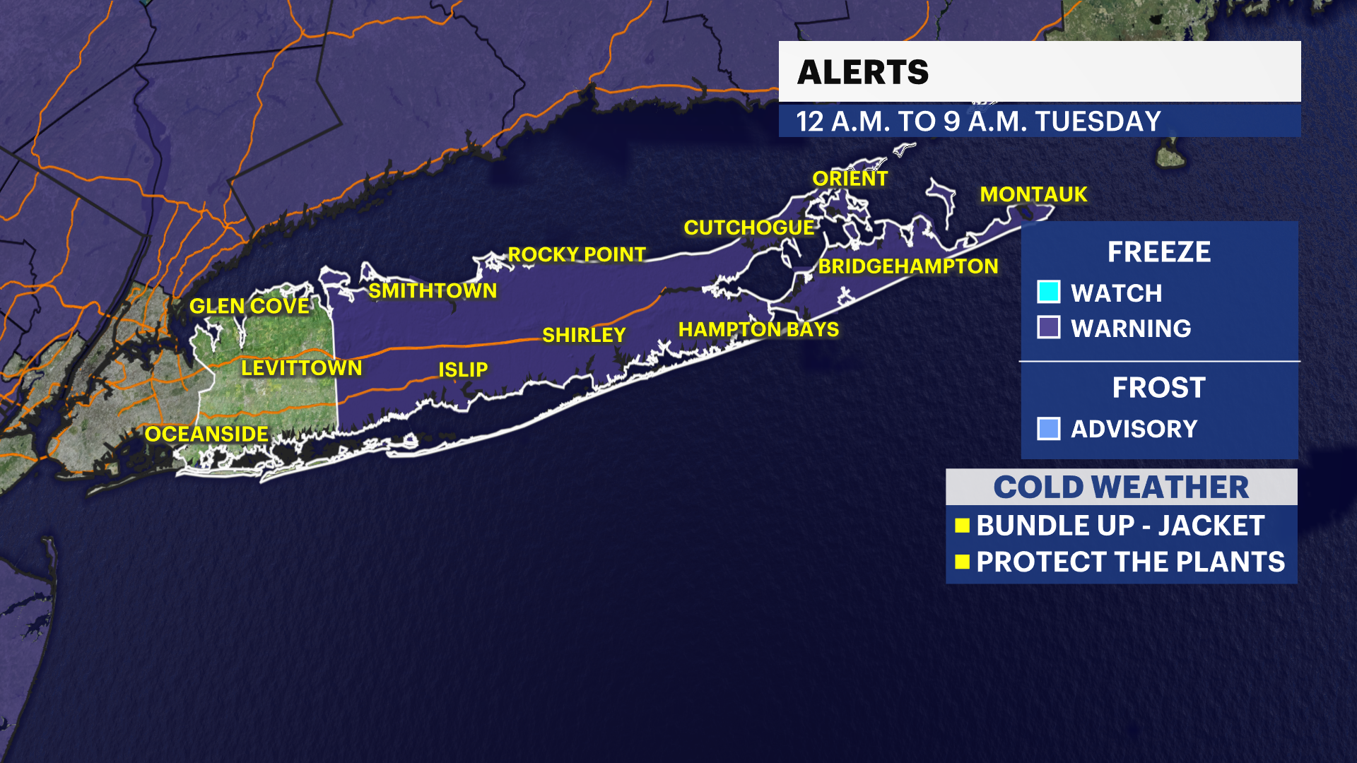
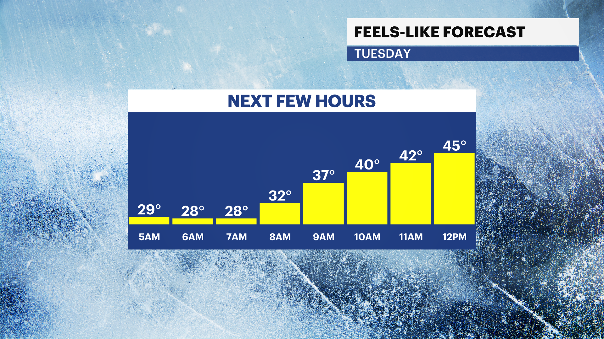
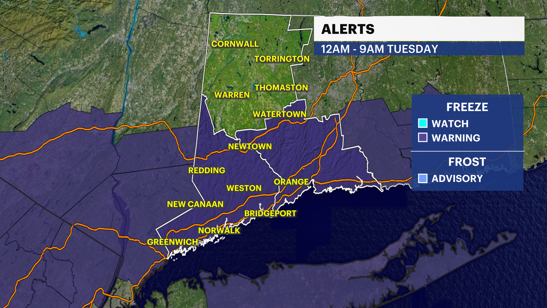
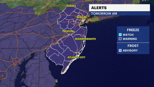
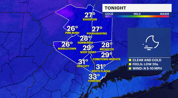
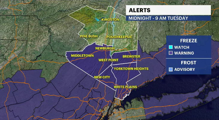
Overnight: Skies will be mostly clear, and it will remain cold. Temperatures will drop into the upper 20s to low 30s by early Tuesday morning. A freeze warning is in effect for Westchester, Rockland, Orange, and Putnam counties. Be sure to protect the four P's: people, pets, plants and pipes.
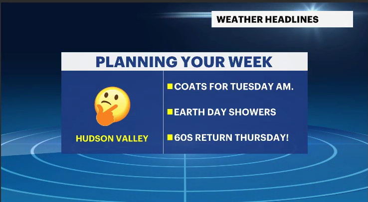
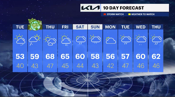
Tuesday: A cold start with early frost, followed by a mix of sun and clouds. Temperatures will reach the upper 40s to near 50 degrees.
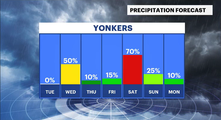
Tuesday night and Wednesday (Earth Day): Showers develop overnight Tuesday and continue into Wednesday morning. Keep the umbrella handy early, then the skies begin to clear out for the afternoon. It will remain on the cool side with temperatures in the 50s.
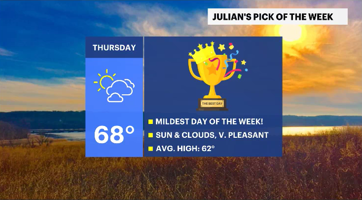
Rest of the week: Temperatures gradually rebound through midweek. Thursday is shaping up to be the "Pick of the Week," with a mix of sun and clouds and temperatures climbing into the upper 60s.
Friday and the weekend: Temperatures slip back slightly on Friday with a chance for scattered showers. The unsettled pattern continues into the weekend, with more clouds, periodic rain chances, and cooler conditions returning.
A brief warm-up is ahead, but the overall trend remains changeable heading into the weekend.